Pages

Friday, August 12, 2016

Signal Hill, Terry Fox, Quidi Vidi, Cape Spear

Out to Signal Hill this morning. Very lucky to have a high overcast day because St Johns has the least sunshine in Canada and maybe North America. Perfect temperature to view the exhibits and walk the trails. People saw whales breaching. Signal Hill was conquered many times by the French and English in the 1600 and 1700s. Very strategic point for the warring Europeans as it has an incredible view of the ocean. Marconi also set up a receiver here and made history by receiving the first Transatlantic radio signal in 1901.

People watched for boats and relayed who was arriving in harbour using flags

From the top of Cabot Tower overlooking St Johns

St Johns Harbour from Signal Hill

Some of the remaining guns aimed towards Cape Spear on the far point.

Heard the Noon Gun while visiting a Newfie with a Newfie.
Newfies were mascots for the Newfoundland Regiments.

Down the hill to Mile 0 of the Marathon of Hope. Terry Fox's memorial.


Loved this building, nearby Mile 0
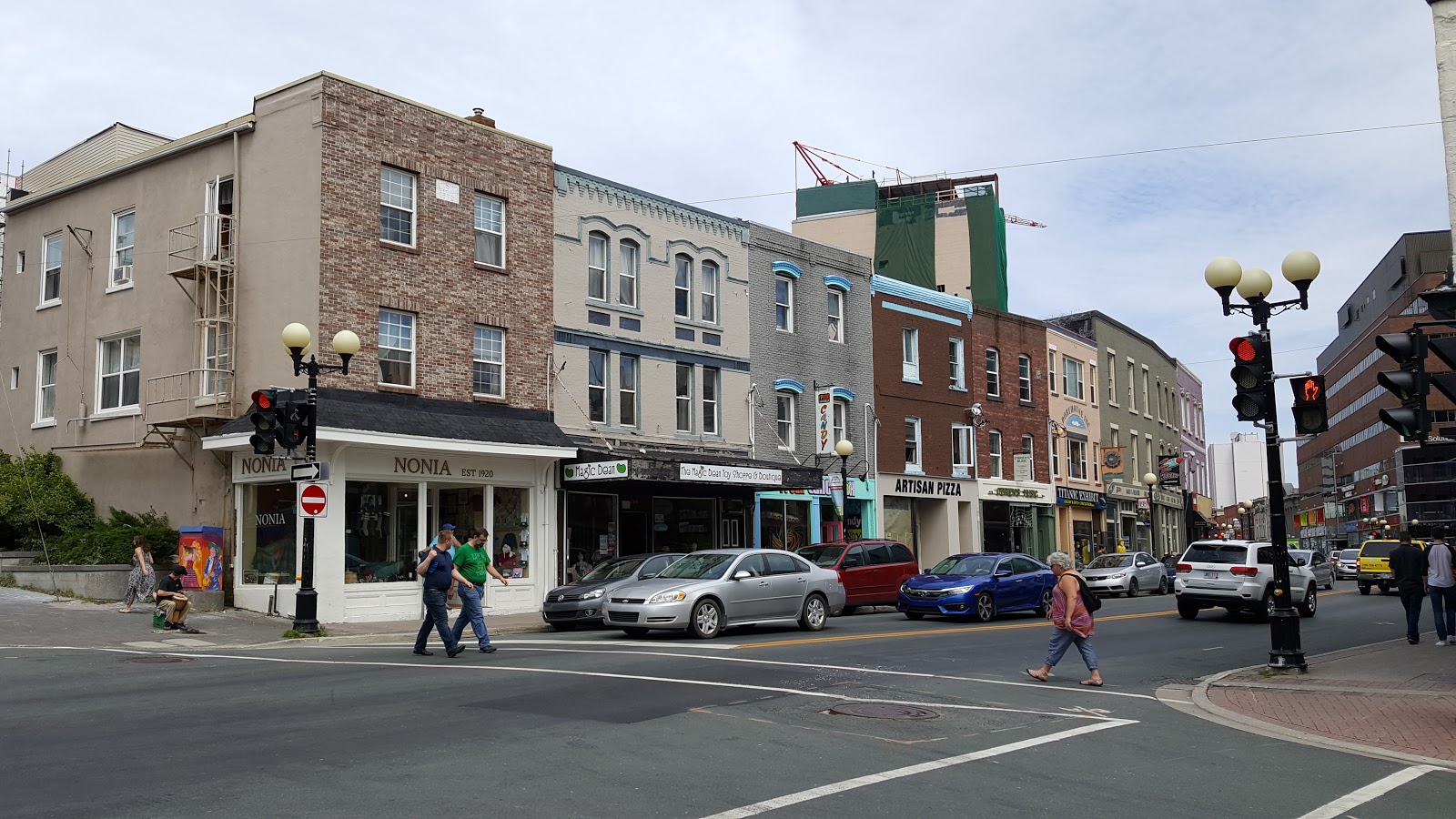
Water Street, the oldest street in North America

On the bike again to Quidi Vidi Harbour. Has the oldest Micro Brewery in the Province and one of its beers uses Iceberg water in its recipe. Had a talk and tour of the brewery.

Quidi Vidi Harbour

Another angle with the Brewery

Might take a while, but I think I can

Quidi Vidi's recent advertising campaign.
Note the bottom caption...
"Results may very"

Onto our last stop of the day! Cape Spear, the furtherest East point of land in North America!  Walked the trails and visited the World War 2 gun Batteries placed here.
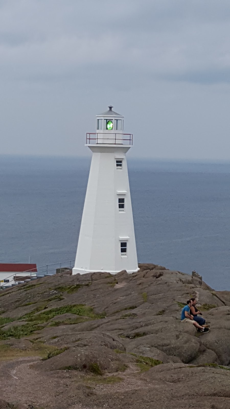
Cape Spear Lighthouse, Still operational with the original Fresnel Lens


Noting Newfoundland's oldest operating lighthouse


Very Surreal knowing that we have gone as far east in North America as one can travel! From here we are heading west and coming home.....


Thursday, August 11, 2016

More travel, To St Johns

Up and on the road.  Only 425 kms to go.  Arrived in early afternoon to Pippy Park Municipal Campgrounds in St. Johns. Set up and relaxed for much of the rest of the day. Went for a nice long walk around Long Pond in the park as all of us needed it, then bedded down, ready for the big day, tomorrow.

Wednesday, August 10, 2016

Travel Day from St Barbe to Grand Falls, Windsor

Beautiful sunny morning, conditions couldn't be better for riding but we had to drive.  Stopped in Port Au Choix National Park and learned about the 4 different peoples that occupied the area during the last 6000+ years. Drove back down the Viking Trail to Highway #1 and then started heading west. Arrived in Grand Falls Windsor to the Walmart parking lot. Picked up groceries and settled in with the other vagabonds for the evening. All the gypsies told and listened to many stories.

Current Port Au Choix townsite and bay

More of Port Au Choix

Gros Morne Park

Viking Trail highway and ocean

Tuesday, August 9, 2016

L'anse Aux Meadows and St Anthonys

As we were preparing for today's ride with the weather iffy, it started to drizzle. Headed out in light rain with rain soaked pavement. Within 1/2 an hour pavement dried and roads were straight and fairly flat. Saw our first moose munching away in a field. Kept on dodging rain clouds all the way to L'anse Aux Meadows (the Parks Canada Viking settlement Exhibit). The reason why this exhibit is significant is that it proves that homo- sapiens had circled the globe 1000 years ago from the original ancestors that came out of Africa over 100,000 years ago.

The meadow where the Vikings landed and used as an outpost for about 10 years

One of several spots the original sod structures were found.

Yours truly at the entrance to a replica sod structure

Replica of a work area

Roof truss structure

Typical items in a Norse household

Reenactment of life for the Norse

Typical items they ate, herbs, nuts and eggs

Depictions of Leif Erikson and a Norse woman

After leaving the Viking site, headed to St Anthonys in search of icebergs. People that we talked to said there were icebergs in St Anthonys Bight, a larger arm of St Anthonys Harbour. As we were looking at the icebergs from the road, a local stopped and gave us directions down a dirt road to the beach for the best view...
Julie seeing an iceberg for the first time.

Notice the town of St Anthonys in the background


We hiked out to a point and were very close to an iceberg.
A french couple took our picture..

While we were there, one of the icebergs split apart. Very cool the sound it made.

As a segway, this berry is locally called Applebake or better known as Cloudberry. Currently in season, saw many people on the side of the highways picking them, as we were informed, they can make $50 per gallon. Very labour intensive as only 1 berry grows on one stem.

Lovely hand model, guess who

Keep seeing gardens at the side of the highways and roadways. People apparently plant gardens anywhere there is a patch of fertile soil and nobody bothers them. Liked these gardens as they had guards.


Then we headed into St Anthonys and to the lighthouse. We saw whales breaching throughout the bay. Quite a ways off. Pictures would not have turned out, but we watched for over a half hour as it was quite the show.

As we rode back to St Barbe, 170kms away, able to dodge almost all the rain clouds. Only got misted twice and not enough to completely wet the windshield. All in all, was a great great day.


Monday, August 8, 2016

Red Bay, Labrador

Last night after writing the blog, we went for a walk in the fog. No wind and the little vampire black flies were all over us. Julie woke up with welts across the back of her neck under her hair. Kyle wanted in the camper, this is not like him... After he spread out on the couch, little black flies emerged from his fur and we swatted flies for a half an hour, many were filled with blood. Apparently he didn't like the little blood suckers either.

This morning we woke up to clearer weather and by the time we decided to hit the road, the cloud ceiling had lifted enough that we could see the ocean. As we drove north, the coast was devoid of trees and very speckled with rock outcroppings and little ponds. Passed over a few rivers with water red in colour.

Pinware River 


Forteau

After an hour of navigating patched potholes road that they want to call a highway, where the speed limit is 80kph and if you were to do the speed limit, it would beat the crap out of your vehicle, we arrived at the end of the "pavement" and Red Bay. 

Have to say that the Red Bay National Park exhibit was worth the torture we were subjected to. This exhibit about Basque people from France/Spain area 400 years ago, came over and set up camp here to whale for oil. Was amazing!  Totally enjoyed the history lesson. Had no idea how or why this was done or by who. Added to this is the fact that a Basque merchant ship sank in the harbour and was excavated, then returned to its resting place for preservation. Great Day!

Whalers used this Chalupa to harpoon the whales. This was found with the sank merchant ship.

Right Whale left fin bones

Saddle Island where the merchant ship sank

Red Bay

Inner part of Red Bay

Red Bay from the Road.

While at the exhibit, talked to other people that said they had a problem booking passage back to Newfoundland, so en-route we tried to phone for a reservation and no one answered, so decided to go to the ferry terminal. At the terminal, the ticket agent said that we could board tonight but the next 2 days were booked... Came back in an hour to wait for the boat. Needless to say, we didn't get to the Quebec coastal villages.


Sunday, August 7, 2016

Viking Trail

After another night of people caring on until after 1am in a campsite that is supposed to have a 10pm quiet time, we were woken up around 4am to an amazing light show, preceded by a base melody of thunder. As the summer opus ramped up, lights could be seen through our top vent and through closed eyelids as the percussion got closer and louder. Thinking that this melody couldn't get any better,  the claps were so close it shook the camper and then thunder cymbals on the roof of the camper as the  climax of the amazing mother's natures demonstration. It absolutely poured until about 7:30 in the morning.

After crawling out of bed and downing to 2 large mugs of coffee, today's decision was which way to drive to avoid being part of last night's production... Decision called, we are heading north up to the north west coast on the Viking Trail. Packed up, on the road...

Apparently, we trailed behind the tail edge of the storm and witnessed downpours at the base of some mountains while travelling through Grose Morne National Park. Stopped in Cow Head and had a Moose burger. The cafe proprietor and her husband shot the moose themselves the previous hunting season. Very tender tasty burger.

Carried on up to St Barbe. Weather was clearing by this time and thought it may be a good idea to take the ferry over to Labrador before the next wave of rain shuttles in. Ticket office lady says that the boat is in and leaves back to the other coast in an hour. Decision made...  Needless to say, we are touring about 160kms of the coast of Labrador and Quebec..

It appears this area is very flat

Grose Morne, rain in the distance


Cow Head peninsula

Swedish boat to Quebec and Labrador

Ferry arrived in Blanc-Salon, Quebec. A short drive to Labrador. Totally fogged in! Hope we can see something tomorrow?

Saturday, August 6, 2016

French Ancestors Route (near Stephenville)

Rain started falling about 3am as forecasted.  Then lightening and thunder, then torrential downpours until about 8am. Needless to say, we didn't get up very early this morning. About 10:45, we ventured out on the bike towards Stephenville. Temperature was a balmy 20ºc with a mix of sun and cloud. Weather kept on getting better as we rode south from Corner Brook. Destination, Port au Port Peninsula and Cape St George. Great roads today, punctuated with the odd rough spot, but we are used to the rough patches by now. Great scenery, with very few trees along the shoreline, we kept riding instead of stopping to take pictures. First the south coast, wind was creating large rollers on the sea. Around the north side the rocks were wind swept and trees could only grow where they were sheltered in depressions. Gave for some fabulous views. Cute little villages all along the coasts with many new or near new homes. What surprised us is the size of the homes with 2-3 bay garages attached and huge garage/workshops adjacent to these homes. People are not hurting around here, for that matter, it appears to us that the equalization payments of the "have provinces" have been well spent in all of the Maritimes, on peoples new homes, vacation trailers ATV and all sorts of recreational vehicles. Businesses selling lawnmowers also must be making a killing. Talking to fishers, they work about 2 month of the year and get EI for the remainder, making about 200k annually...... Maybe we will see something different as we head further east but the road is getting shorter by the day..

Check out the house and garage to the left, the norm, not the exception..

The Gravels - French Newfoundland

Description of Port au Port Peninsula

Friday, August 5, 2016

Cox's Cove and Lark Harbour

Left Codroy Valley and headed to Corner Brook. Arrived at campsite in early afternoon. Once set up, rode to Cox's Cove which is on the north side of the Bay of Islands, Humber Arm. This is called Admiral Palliser's Trail in the Newfoundland guide book.  Pretty little bay and community.

Cox's Cove

Dories and fish processing plant


Down the road again to the south side of the Humber Arm to Lark Harbour. This route is called Captain Cook's Trail. Very scenic little villages on the way reminded us of Indian Arm and Ioco in Burrard inlet back home in BC.

York Harbour

Lark Harbour

Notice the Cemetery